
Travel story 8 min read
MyTravelBuddy Stories
The Kathmandu Valley's Best Days Are in Its Other Towns
Most visitors sleep in Thamel and come out for the afternoon. The valley is really a ring of old towns — Bhaktapur, Changu Narayan, Nagarkot, Dhulikhel, Panauti — and the good hours happen before the buses arrive. Where to sleep, which morning to give to the ridge, and why the clear window is right now.
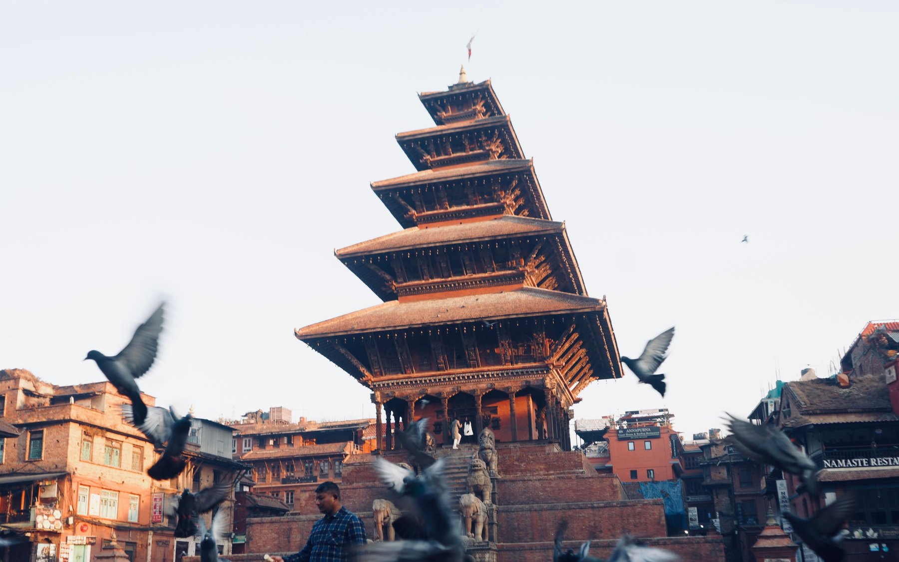
Taumadhi Square, Bhaktapur, before the ticket booths open. Photo: Dinesh lens / Pexels.
At twenty to seven in the morning, Bhaktapur's Taumadhi Square belongs to the pigeons and to whoever is feeding them. The Nyatapola's five roofs stack up into a sky that has not decided on blue yet. A man in a check shirt throws a handful of grain and the whole square lifts. Somebody is sweeping brick. Somebody else is carrying a steel urn of tea. The ticket booths will not open for another two hours, and the buses from Kathmandu are still being loaded, forty minutes away.
This is the part of the Kathmandu Valley that most visitors book a flight for and then never actually see, because they sleep in Thamel and come out for the afternoon. The valley is not a city with monuments around it. It is a ring of old towns — three of them were separate kingdoms, all three within an hour of each other — and the good hours in each of them happen early, before the day-trip rhythm arrives and after it leaves.
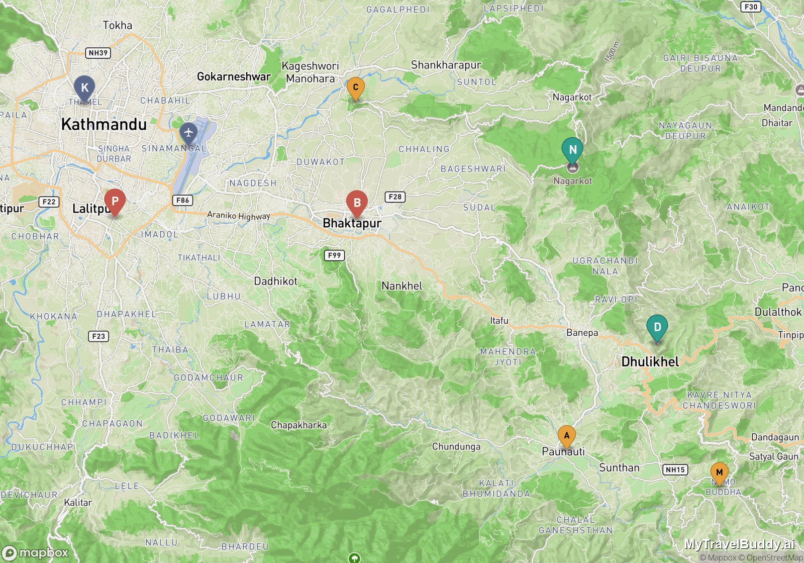
K Kathmandu, P Patan, B Bhaktapur, C Changu Narayan, N Nagarkot, D Dhulikhel, A Panauti, M Namobuddha. The whole ring fits inside about 35 km.
Sleep in Bhaktapur, not in Thamel
The single decision that changes this trip is where you put your bag the first night. Bhaktapur is twelve kilometres from Tribhuvan airport and Google routes it at around half an hour in normal traffic — slightly closer to the runway than Thamel is, and with far less of the city to grind through. From Thamel, the same trip to Bhaktapur runs about sixteen kilometres and closer to forty minutes, which is exactly the gap that makes everyone arrive at eleven and leave at four.
Stay inside the old city and the ticket, which foreigners currently pay somewhere in the NPR 1,800–2,000 band (around US$15, and it has been revised more than once — confirm at the booth), stops feeling like an entry fee and starts feeling like a residence permit. It covers the whole old town rather than one square, and it can be extended for the length of your stay if you ask when you buy it. That is the difference between seeing Bhaktapur and living in it for two days.
What you get for staying is the walk I keep thinking about: Pottery Square, where the drying rows get laid out early, up through Durbar Square and Taumadhi to Dattatraya Square at the eastern end. It is a little over a kilometre. Fifteen minutes if you are walking it. Two hours if you are doing it properly, which means stopping for a clay cup of juju dhau and watching a courtyard wake up. Do it at seven. Do it again at six in the evening, when the stone is warm and the squares go back to being somebody's front yard.
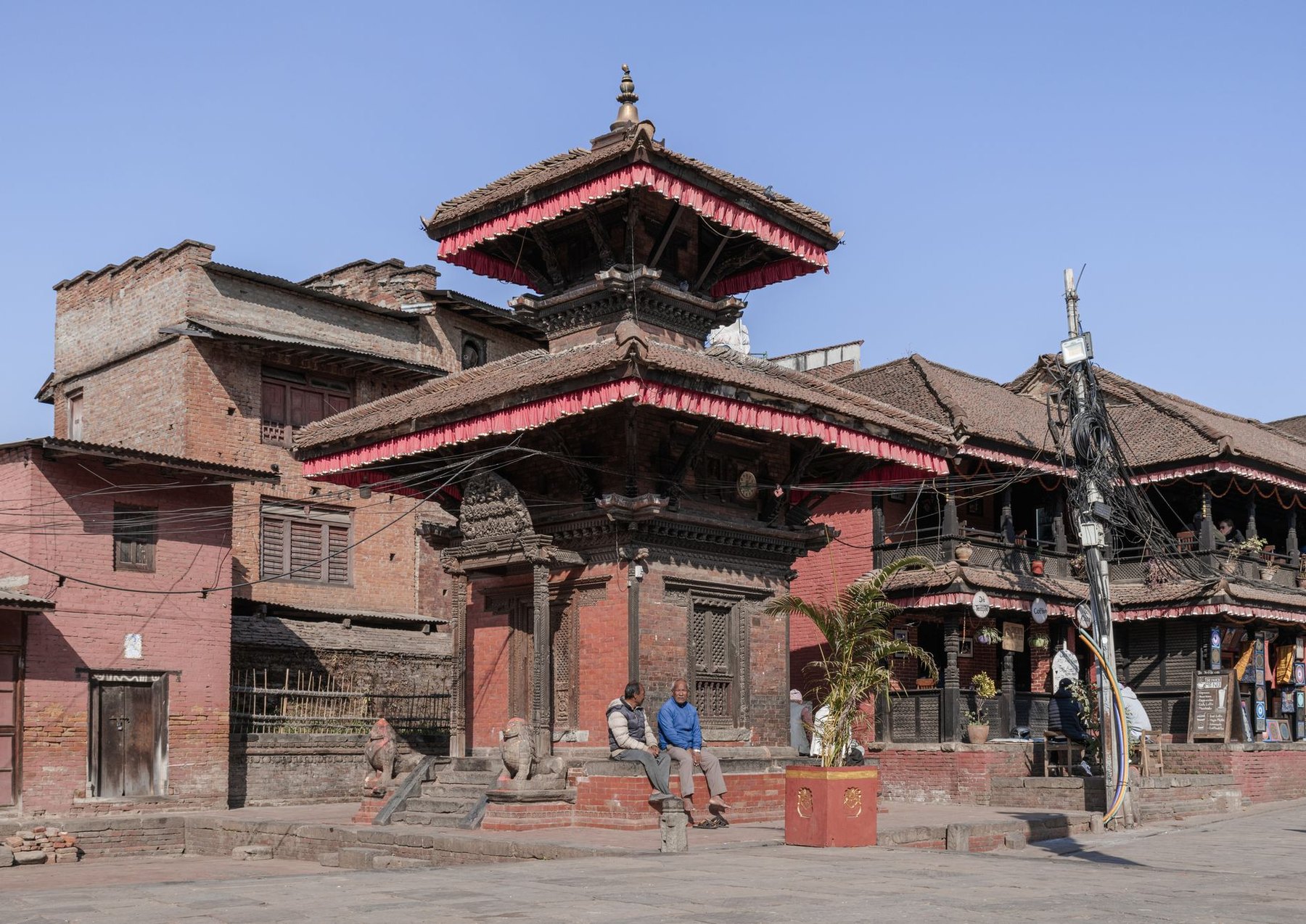
Mid-morning in Bhaktapur, after the sweep and before the buses. Photo: Roman Saienko / Pexels.
The morning you give to the ridge
Changu Narayan sits on a long ridge north-east of Bhaktapur, and the walk up to it is the valley's most undersold half-day. Google gives the route about 5.9 km and an hour and a half on foot, climbing out of the brick streets into terraces. The temple itself opens at 07:00 and closes at 19:00, costs a few hundred rupees, and holds some of the oldest stone carving in Nepal — this is the place people mean when they say the valley is a museum nobody curated.
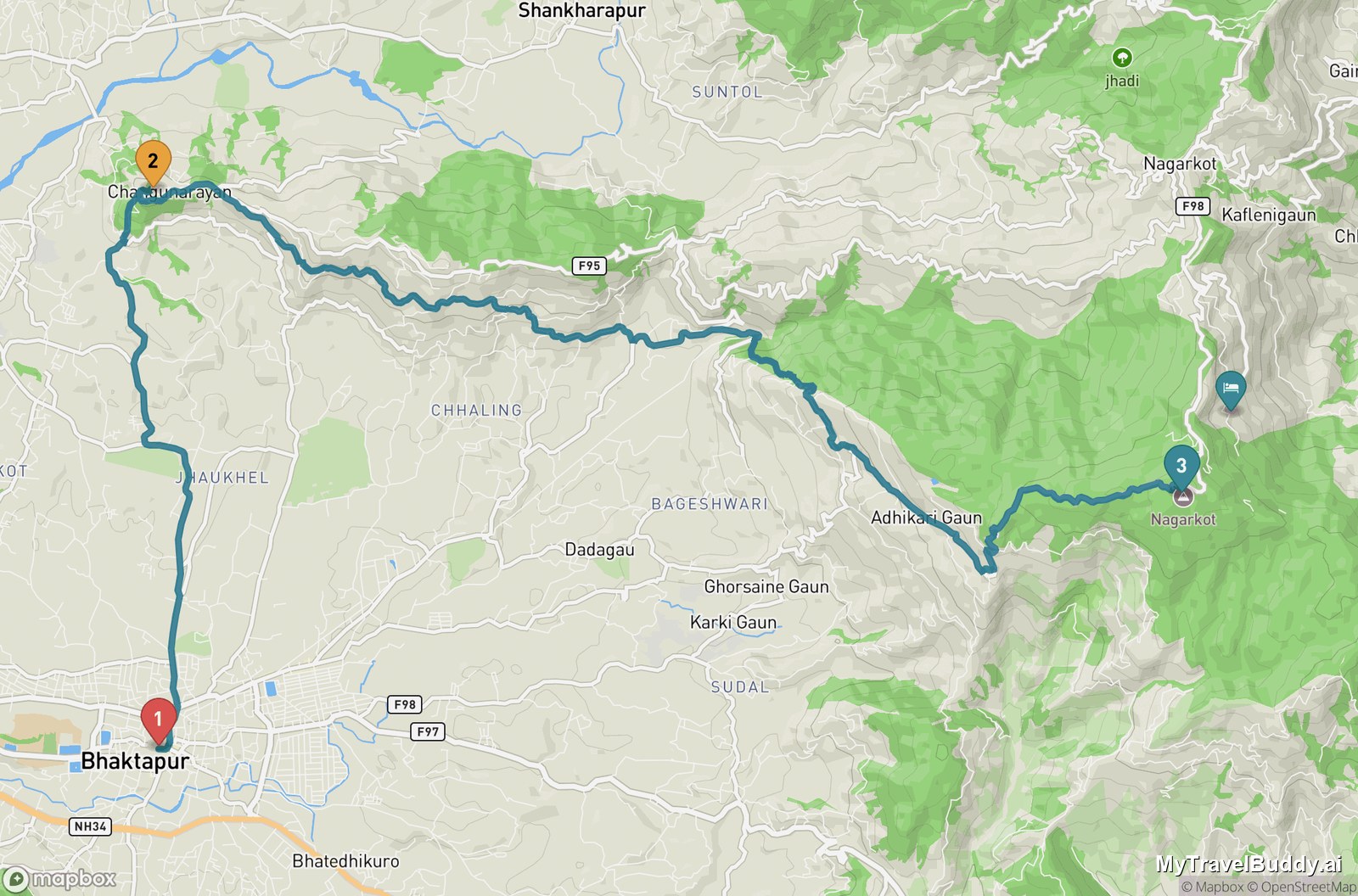
1 Bhaktapur, 2 Changu Narayan, 3 the Nagarkot tower. The full line is about 20 km.
If you keep going east, the ridge runs all the way to Nagarkot: roughly 13.9 km more, close to four hours, for a full-day total near 20 km and five and a half hours of walking before stops. That is a genuine day, not a stroll, and it ends at 2,143 m — eight hundred metres above the valley floor. The honest version for most people is to walk as far as Changu Narayan, have lunch on the ridge, and take a jeep or taxi onward; Bhaktapur to Nagarkot by road is only about 13.5 km, but hairpins make it a thirty-five-minute drive.
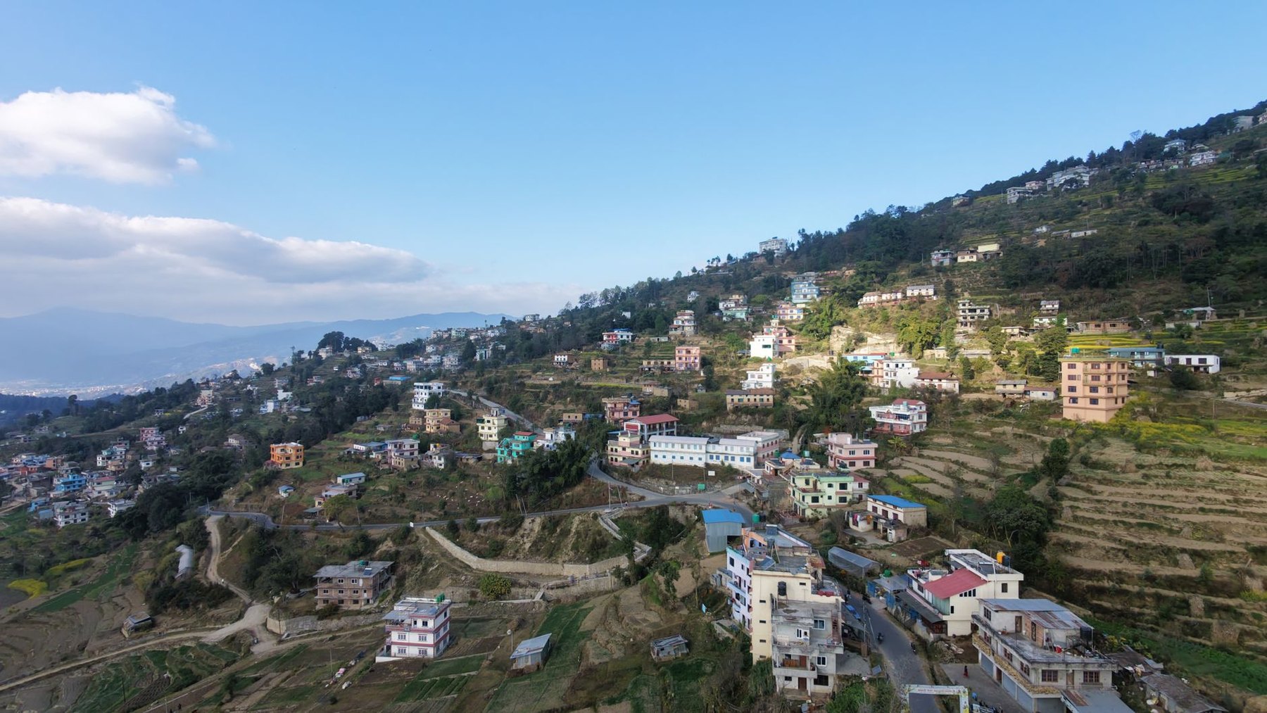
The eastern rim near Nagarkot. The valley floor is the pale band on the left — on clear mornings the Himalaya sit above it, and by mid-morning the haze has usually closed the view.
Nagarkot or Dhulikhel: pick by temperature, not by view
Both rim towns sell the same thing — a window seat for the Himalaya at dawn — and both deliver it only on the mornings the air cooperates. The real difference is altitude, and it shows up in the forecast. Over the coming fortnight, Nagarkot at 2,143 m runs daytime highs around 18–21 °C and nights down to 9–11 °C. Dhulikhel, nearly eight hundred metres lower at 1,372 m, sits at 23–25 °C by day and 10–13 °C at night — essentially valley weather with a view attached.
So: Nagarkot if you want the higher, colder, more dramatic sunrise and do not mind that there is not much town to walk around afterwards. Dhulikhel if you want a sunrise and somewhere to spend the rest of the day, because Dhulikhel is a working Newar town with its own old quarter rather than a line of viewpoint hotels. They are about 20 km and fifty minutes apart on the rim road, so a single night in each is a reasonable way to refuse to choose.
A word about the view itself, because it is routinely oversold. From this part of the rim you are looking at Langtang, Ganesh Himal and the Dorje Lakpa group — real Himalaya, a long way off. Everest is occasionally claimed and very rarely seen. Treat anything you do get as a gift, be outside by about 06:00 (sunrise through late October runs 06:06 to 06:15 and drifts later), and accept that the window closes fast: the valley's haze usually builds by mid-morning and the peaks go.
The quiet end of the ring
South-east of Dhulikhel, the valley stops performing. Namobuddha — a hilltop Buddhist site with the Thrangu Tashi Yangtse monastery, open around the clock — is about 13 km on by road, thirty-five minutes, or a serious 12.6 km, three-and-a-half-hour walk if you want to earn it. From there it is 9 km and about twenty minutes down to Panauti, a small town at the confluence of two rivers with the Indreshwar Mahadev temple at its centre and almost nobody in its lanes. Panauti back to Kathmandu is around 33 km and an hour and twenty.
Save Patan for the end, on your way back through. It is 6.6 km from Thamel, under twenty minutes by car, and the Patan Museum inside the old palace is open 08:00–18:30 every day — the best-explained building in the valley and the one place where the carving you have been walking past for three days is finally labelled. Patan's square costs about NPR 1,000. Budget roughly NPR 5,900 if you intend to pay into all seven of the valley's major heritage sites, bring rupees in cash, and carry your passport if you hold a SAARC nationality, because the discount is substantial and only applies if you show it.
What to know before you book this month
Dashain. In 2026 the festival runs 11–25 October, with tika day on Wednesday 21 October and much of the country's officialdom closed roughly 17–24 October. The valley is beautiful and emotional during it; it is also emptier of workers, fuller of families travelling, and some shops and offices simply shut. Tihar follows on 7–11 November. Neither is a reason to stay away — but if you need a bank, a permit office or a particular restaurant, plan around them.
The weather window is now. The current forecast for the valley is close to cloudless from about 23 to 28 October, with highs of 24–27 °C in Bhaktapur and dry days throughout, before cloud cover creeps back toward the end of the month. That is the post-monsoon air everyone comes for, and it is a forecast, not a promise.
Mobility. Be clear-eyed about this one. The old towns are brick, stone and steps, the temple plinths are steep, and there is essentially no step-free route through Bhaktapur's squares. A ground-floor room near Taumadhi and a hired car for the rim is a much better plan than trying to walk the whole ring.
What to skip. If you are short on days, skip the second Durbar Square in Kathmandu city and keep Patan. Skip the Nagarkot sunrise if the evening sky is already grey — you will sleep better and lose nothing. And skip the idea that you need to tick off all seven heritage sites; two towns, properly, will stay with you longer than seven squares at speed.
If you are planning this one, the piece worth keeping notes on is the order — which town you sleep in, which morning you give to the ridge, and which dawn you gamble on the mountains. It is the kind of trip where a travel buddy that remembers your route and watches the forecast with you earns its place, because the whole thing hinges on being in the right town at six in the morning.
Three nights is enough. Four is better. Either way, set an alarm you will resent, and be in a square before the booths open.
Continue wandering
One more story for the road
October 18, 2026 · Maya Roam
Skip the Boat and Walk Hermanus's Cliff Path
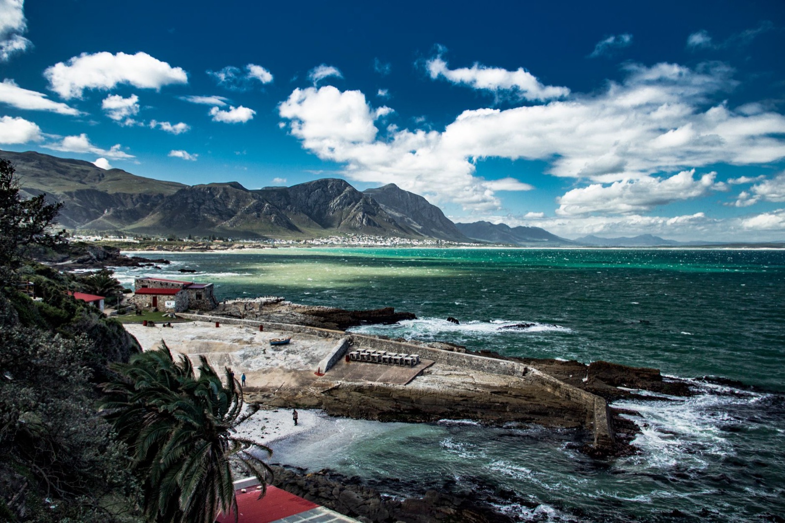
In Hermanus the southern right whales come to the edge of town, and the town built a free footpath along the whole edge. The sections that matter, why wind decides the day more than the date, and where to stand when Gearing's Point gets busy.
Read nextInspired to go?