
Travel story 9 min read
MyTravelBuddy Stories
Hobart to the Bay of Fires, With a Day on Maria Island
Tasmania's east coast is an easy drive and a hard trip to plan well. Hobart to Binalong Bay is 318 kilometres and about four and a quarter hours behind the wheel, spread over four days — but the day that decides the tri…
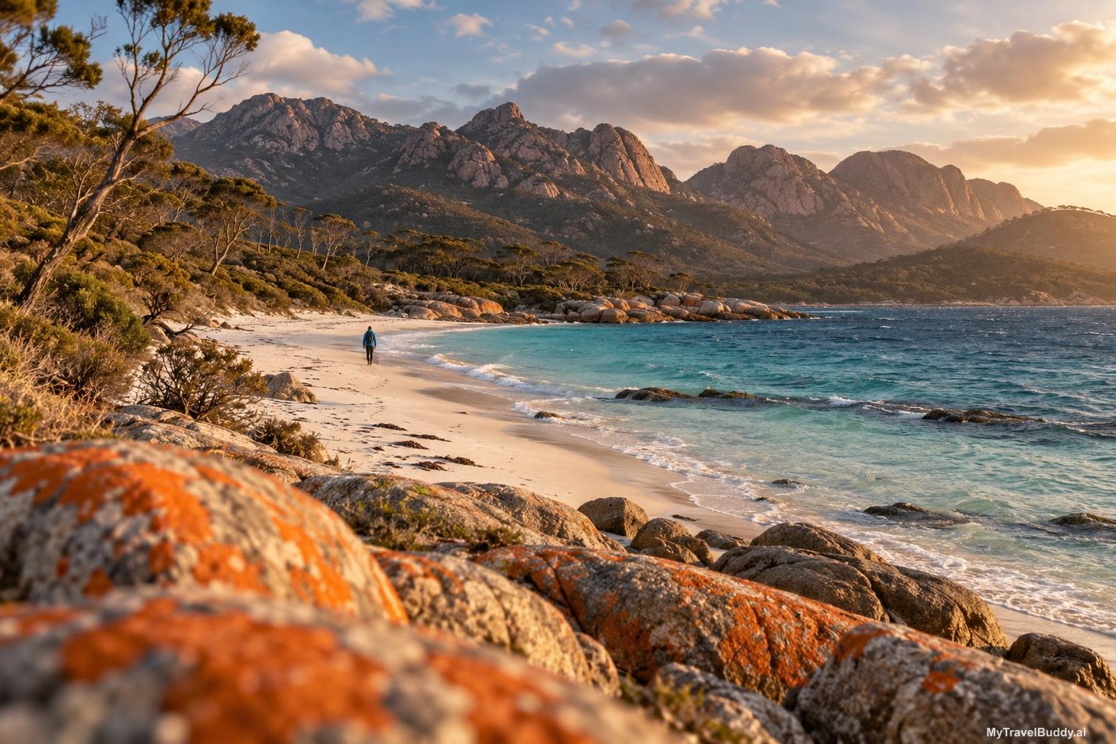
There is a stretch of the Tasman Highway, somewhere past Orford, where the bush drops away and the Tasman Sea just appears — too blue for the temperature, with the wind pushing white lines across it. I pulled over the first time I drove it, which everyone does, and which is why there is a gravel shoulder there at all.
Tasmania's east coast is an easy drive and a genuinely hard trip to plan well, and the reason is almost never the road. It is a ferry timetable, a national park pass, and the fact that in October the island can swing ten degrees between a Tuesday and a Saturday. Get those three right and four days up this coast is close to perfect. Get them wrong and you spend an afternoon sitting in a car park at Triabunna.
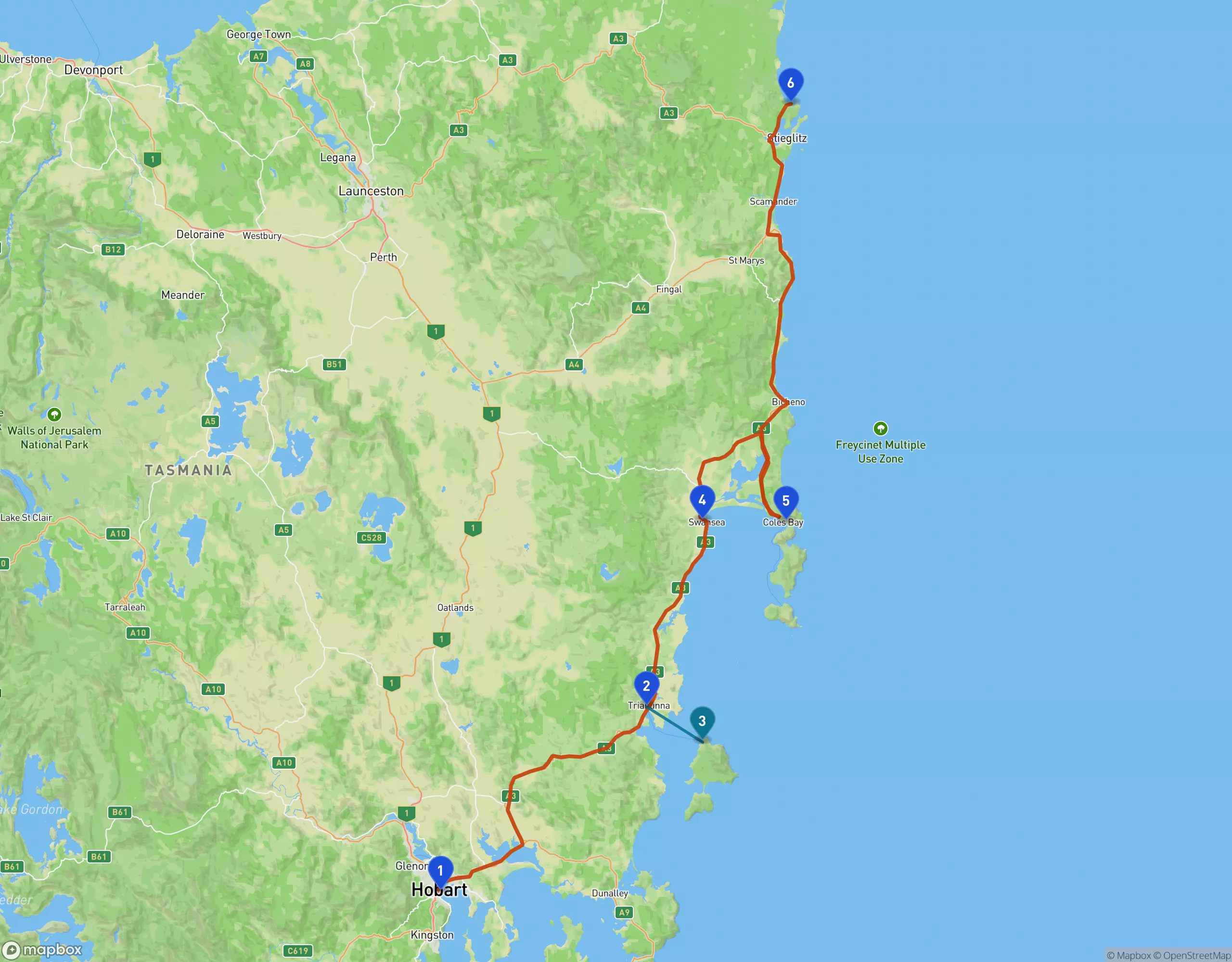
Hobart (1) to Binalong Bay (6) is 318 kilometres and about four and a quarter hours of driving, spread across four days. The teal line is the only leg you cannot drive: the thirty-minute ferry from Triabunna (2) to Maria Island (3).
Hobart to Binalong Bay is 318 kilometres and about four and a quarter hours of actual driving, split across four days. That is the whole trip: a little over an hour a day behind the wheel. Everything else is the point.
Day one: get to Triabunna, not past it
Hobart to Triabunna is 85 kilometres and roughly 70 minutes. It is tempting to treat this as a transit leg and push on to Swansea for a nicer dinner. Don't. Sleep at Triabunna or Orford, because tomorrow's ferry leaves at 8:30 in the morning and you want to be ten minutes away from it, not an hour.
Leave Hobart after lunch and give the morning to the city instead. If it is a Saturday, Salamanca Market fills the sandstone warehouses on Salamanca Place and runs through the morning; if it is not, the same waterfront is quieter and better. Then drive. The road through Sorell and Buckland is farmland and low hills, pleasant rather than spectacular, and it saves the coast for the end.
Day two: Maria Island, and the only timetable that matters
Maria Island has no cars, no shops, and no food. It has a World Heritage convict station, cliffs painted in iron oxide, and more visible wildlife than anywhere else you will go on this trip. It is reached only by the Encounter Maria Island ferry from Triabunna — about thirty minutes across — and bookings are essential, not advisory.
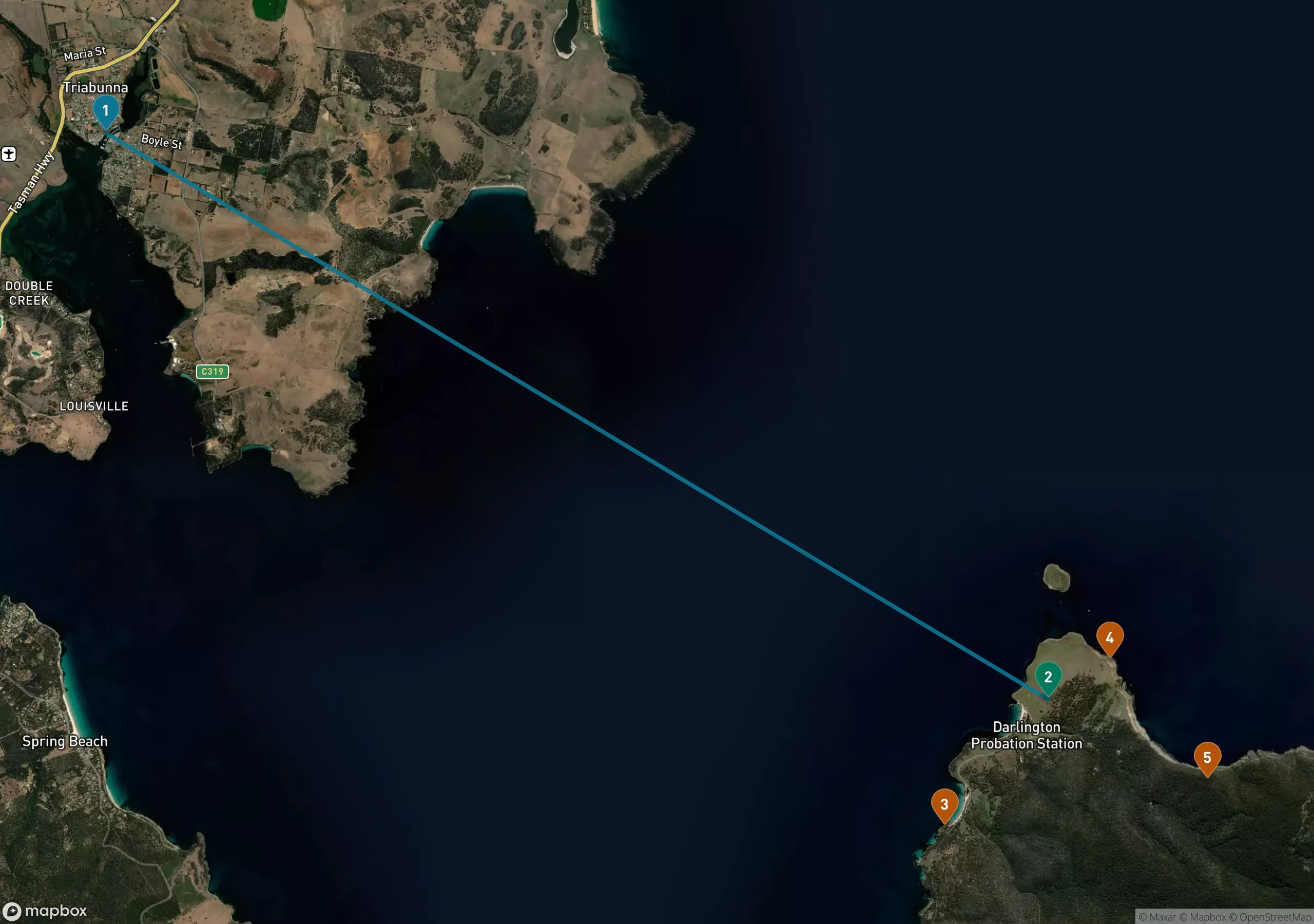
Thirty minutes of water, and the reason the timetable runs your day: Triabunna (1) to Darlington (2), with the Painted Cliffs (3), Fossil Cliffs (4) and Bishop and Clerk (5) all reachable on foot from the jetty.
Here is the thing nobody tells you. On the summer timetable, which runs September through April every day except Christmas Day, ferries leave Triabunna at 8:30, 10:00, 11:30 and 15:15. They come back at 9:15, 10:45, 14:30 and 16:15. Read those two lines together and the day plans itself: there is no return sailing between 10:45 in the morning and 2:30 in the afternoon.
So the 8:30 out gives you roughly six hours if you come back at 14:30, or nearly eight if you hold out for 16:15. The 11:30 out leaves you three hours, which is enough for Darlington and the Painted Cliffs and nothing else. And the 15:15 departure pairs only with the 16:15 return — one hour on the island, most of it walking up from the jetty. Take the 8:30. If the 8:30 is booked out, take the 10:00 and accept that you are choosing between the cliffs and the ridge.
With a full day: walk up to the Darlington Probation Station first, because it is right there and because the convict buildings make more sense before the landscape distracts you. Then the Painted Cliffs on the western shore, which are sandstone stained into honeycomb patterns by groundwater and are best at low tide — check the tide board at the Maria Island Gateway when you check in for the ferry, or the QR code posted at the Commissariat Store, before you commit to the walk down. Fossil Cliffs loop north of Darlington is the easier of the two big walks. Bishop and Clerk, climbing the dolerite on the northeast, is a serious four to five hours and only worth it with the early ferry and good visibility.
One genuine caveat for this year: Parks is midway through a water, wastewater and electrical upgrade around Darlington that began in December 2025 and is expected to finish in November 2026. That means heavy machinery, noise and dust in and immediately around the settlement. It does not touch the cliffs or the walking tracks, but it does mean Darlington itself is a construction zone rather than the hushed ghost town the photographs promise. Plan to move through it and out.
And bring lunch. There is no food on the island, and the last ferry is the last ferry.
Day three: the slow 108 kilometres to Coles Bay
Triabunna to Swansea is 49 kilometres and 37 minutes; Swansea to Coles Bay another 59 kilometres and 46 minutes. Together that is under an hour and a half of driving, which you should stretch across most of a day.
Stop at the Spiky Bridge just south of Swansea — convict-built, with field stones stood on end along the parapet like teeth, apparently to stop cattle walking off it. It takes four minutes and is directly beside the road. Kelvedon Beach, a little further south, is the kind of long empty sand that makes people reconsider their lives.
North of Swansea, the turnoff to Dolphin Sands leads to Melshell Oyster Shack, where the oysters come out of Moulting Lagoon a few hundred metres away and you shuck them yourself at outdoor tables. Then Devil's Corner at Apslawn, where the cellar door has a lookout tower aimed straight across the water at the Hazards. You are looking at tomorrow from here, which is a nice way to arrive.
Day four: Freycinet early, then north to the fires
The Wineglass Bay Lookout is 2.6 kilometres return — 1.3 each way — and it is steep, graded 3, with stone steps most of the way to the saddle. It takes most people 45 minutes to an hour and a half round trip depending on how often they stop, and the view from the platforms is the one on every poster of Tasmania ever printed.
Go early. The car park at the trailhead fills, and in the shoulder season the light on the bay is better before ten anyway. If the lookout queue looks grim, drive out to Cape Tourville instead: a flat boardwalk loop around a lighthouse with enormous coastal views and a fraction of the people.
Then Coles Bay to Bicheno, 38 kilometres and half an hour, and Bicheno to Binalong Bay, 87 kilometres and a bit over an hour through St Marys and the Elephant Pass country. You arrive at the Bay of Fires in the late afternoon, which is when the orange lichen on the granite does what it is famous for. The name, incidentally, has nothing to do with the lichen — it came from Tobias Furneaux in 1773, who saw Aboriginal fires along the coast. The colour is a coincidence that got the better of the story.
The pass maths, which is worth two minutes
A valid parks pass is required for every Tasmanian national park, and this trip goes through two: Maria Island and Freycinet. A daily vehicle pass is A$49.15 for up to eight people in the car. A Holiday Pass — every national park in Tasmania, up to two months — is A$98.35 per vehicle.
Two daily passes cost A$98.30. The Holiday Pass costs A$98.35. For five cents you get two months and every other park in the state, so if you are entering a national park on two separate days, there is no decision to make. Buy it online at the Parks passes site before you leave, or use the self-service machines in front of the Freycinet Visitors Centre and at the Wineglass Bay trailhead. Travelling by bus, bike or on foot, the equivalents are A$24.55 daily and A$49.20 for the holiday pass. Children under five are free.
On October, and this week in particular
Spring here is not a gentle ramp. As I write, the forecast for the coming week has Hobart opening cold and properly wet — around 12°C with rain almost certain — then climbing to 23 or 24°C and mostly dry by the weekend. Coles Bay follows the same curve a few degrees cooler: about 14°C and drizzling early in the week, 18 to 20°C and clear by Saturday and Sunday, with the wind picking up to around 39 km/h on Saturday.
That is a forecast, not a promise, and east coast weather moves. But the shape of it is the shape of October generally, and the planning lesson holds: if your dates straddle a cold front, put the driving and the convict history at the front of the trip and save the exposed walks — Wineglass Bay, Bishop and Clerk, the Bay of Fires beaches — for the warmer, calmer end. Pack a windproof layer regardless. The water is clear, the sand is white, and the sea in October is genuinely cold; people swim anyway, briefly, and talk about it for the rest of the trip.
Four days, 318 kilometres, one ferry you need to book, one pass you should buy online tonight. The rest of it mostly takes care of itself.
Continue wandering
One more story for the road
October 11, 2026 · Maya Roam
Seoul's North Ridge, East to West
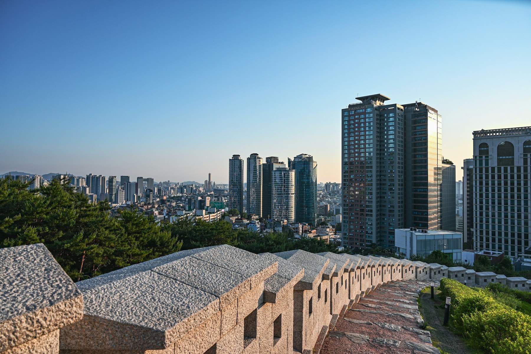
Almost everyone walks the Baegak section of the Seoul City Wall from Changuimun, which means climbing 200 metres of staircase in the first kilometre and finishing at a road junction. Walk it the other way and the climb arrives in instalments and the mountain ends in Buam-dong with a coffee.
Read nextInspired to go?